Ir al contenido
Home » Rural Real Estate in Entre Ríos » Rural Appraisal

Rural Appraisal in Entre Ríos

We are a rural real estate agency with a team of professionals who conduct rural property appraisals throughout Entre Ríos. We perform rural appraisals, determining the true value of your land through a technical visit, satellite technology, and GIS software. This service is ideal for selling, dividing property, settling inheritances, or simply finding out the value of your land.

If you own land in Entre Ríos and need to know its value, or if you have been asked for a rural land appraisal to proceed with a process, this page explains how we work and what you receive at the end of the process.

01

Buying and selling fields

It is the starting point before any operation: it allows setting a realistic offer value, without overpricing that hinders the sale or low values that generate capital losses.

If the goal is sell the field, The valuation is usually the first step before going to market.

02

Successions and inheritances

It provides a legally valid technical valuation, which serves as a transparent and indisputable reference for heirs and lawyers to distribute assets in an orderly manner.

03

Division of condominiums and family property

When the field has several partners or co-owners, the actual composition of environments (agricultural hills, lowlands, mountains or ravines) is evaluated to achieve a fair partition, not a simple geometric division by eye.

04

Loans and banking procedures

Banks and financial institutions usually require a technical rural appraisal file to process loans: the report supports the real value of the land as collateral for the transaction.

05

Find out how much your land is worth today

For those who do not plan to sell immediately but need to decide on a lease or the management of the farm, with the value updated against the fluctuations of the rural market.

06

Legal proceedings and expert reports

In litigation, the expert report responds to the points requested by the judge with soil mapping, satellite records and drone images, substantiating the value before the court.

01

Specialized advice

Before appraising, we seek to understand what the owner needs: to sell the land, to resolve an inheritance, to divide assets among heirs, or simply to know its current value.

This advice is not exclusive to the appraisal: it also accompanies the rest of our rural real estate services.

02

Property valuation

It combines two complementary instances, according to objectives.

First, office work with satellite images, soil mapping and digital tools that allow a first approximation of the value of the field.

Then, an on-site verification (with drones, photographs and tours) where what was surveyed remotely is confirmed: access routes and areas are inspected, crops, pastures, and forests are surveyed, and the condition of improvements and facilities is inspected.

03

Document management

Cadastral data, survey plans, titles and other property documentation are reviewed to ensure that the assigned value is legally viable and transferable.

This work is also part of the processes of buying and selling a field.

01

Comparative market method (comparables)

We thoroughly analyze the history of closed transactions, active offers in the area, and current trends in the rural real estate market.

We cross-referenced this data with real-world references from the region to establish a realistic, defensible market value that is aligned with economic reality.

02

Income capitalization method (expected income)

We evaluate the productive potential of the establishment (agricultural, livestock, mixed or island) to project the income it would generate under lease agreements or direct operation.

This allows us to calculate the value of the land based on its actual capacity to generate wealth.

03

Stratification of environments (productivity scoring)

We understand that a field is not worth the same per hectare.

We break down the total surface area and apply different coefficients according to the actual suitability of each sector: firm agricultural hills, mid-hills, livestock lowlands, ravines, mountains or island areas.

Our hybrid process: technology + territory

Before visiting the establishment, we digitally processed and analyzed all available geographical and historical information.

Technology office (office work)

Before visiting the establishment, we digitally processed and analyzed all available geographical and historical information:

Official soil charts

We consult INTA mapping and official bodies to determine with scientific precision the land use capability classes of your property.

Geographic Information Systems (GIS) and GPS

We mapped the exact polygon of the field to delimit watersheds, analyze the historical risk of flooding, draw contour lines and evaluate road access.

Satellite multi-temporal analysis

We study the actual behavior of the field, its productive history and the crop rotation of recent years through historical satellite images from different climatic campaigns.

On-site survey (technical inspection)

Office technology is only truly validated by being out in the field. We travel to the farm to evaluate every technical detail on the ground.

Infrastructure inspection and improvements

We surveyed the state of conservation, age and depreciation of perimeter and internal fences, paddocks, corrals, chutes, sheds, watering holes and the caretaker's house.

Use of drones for precision mapping

We fly drones over the property to triangulate perimeter points, record complete aerial plans of hard-to-reach areas (grasslands, dense forests or lagoons) and provide a high-definition photographic record, essential to support our report to any buyer or judicial entity.

Human conversation (the voice of local experience)

A professional valuation isn't done solely with screens and satellites; it draws on the daily reality of the property. That's why a cornerstone of our process is direct interviews with key stakeholders in the field.

Owners

to learn about the history of family or corporate management, the investments made and the available cadastral documentation.

Stallholders and managers

We talked to those who live and work the land on a daily basis.

The local worker is the one who really knows the "fair side" of the field: the behavior of the soil in times of heavy rain, the areas that flood first and the real productive history throughout the seasons.

Tenants

We evaluate the experience of those who currently work the land, collecting data on actual crop yields and effective crop rotations.

01

Current state of the property

Before planning anything, we surveyed the current state of the countryside: what is being produced, how it is managed, and under what real conditions.

This starting point is what allows us to compare, later on, between what the field is today and what it could become.

It is revealed both in the office work (recent satellite images) and in the field survey.

02

Suitability for use

We determine what type of use the field supports: agricultural, livestock, mixed or recreational, and under what intensity, intensive or extensive.

Within each aptitude there are nuances that change the value: a livestock field is not the same if it is intended for breeding, raising or wintering, and that definition is part of the report.

03

Property potential

In addition to the current aptitude, we assessed where the field could grow.

The type of soil can indicate room to intensify production or diversify it towards another activity; access and distance to productive areas or nearby cities can open or limit that potential, even due to possible regulatory restrictions associated with the location.

The state of deterioration or the risk of erosion also play a role: a field with good productive potential can have that potential limited if it is not managed in time.

04

Soil type

Land is the technical basis of any serious rural appraisal.

We analyze the type, order, and soil series based on the soil map and official soil charts, which, in addition to classifying the land, indicate specific potentials and risks for each sector: what performs well on a firm agricultural hill does not behave the same in a low-lying area.

This reading is the basis on which the differentiated value coefficients are then applied.

05

Location and access

It is not enough to know how much a field produces if that production cannot then be easily sold.

We evaluate access and distances, whether dirt or gravel, and the distance to nearby or commercially relevant cities.

A dirt road that becomes impassable due to rain, or a long distance to the collection or sales point, directly impacts logistics costs and, therefore, the value of the land.

06

Surfaces

We surveyed the total area of the establishment and, when the field is mixed, the area designated for each use: pastures, farms or woodlands.

To this we add a fact that is often overlooked, the usable surface, because not all 100% of the hectares of a plot or field are used: there are sectors that, although they appear in the title, are not productive.

07

Mountains and vegetation

In livestock or mixed fields, the forest is an additional productive asset, and that is how we evaluate it.

We assess whether it is a clean, dirty, open or closed native forest, the livestock capacity it offers and the type of vegetation present (tree, shrub or herbaceous), including the presence of problem weeds that may affect the quality of the available forage.

08

Erosive problems

In agricultural or mixed fields, erosion is a direct indicator of the future productive capacity of the soil.

We identify if there are erosion problems, and if they are mild or severe, because advanced erosion not only reduces current yield but can also imply a future recovery investment, something that is also reflected in the value of the field.

09

Systematization and installations

We check if the field is systematized, that is, if it has contour lines as an improvement, which usually organizes the flow of water and reduces erosion.

Along with this, we surveyed the general condition of the existing facilities and improvements (fences, water sources, corrals, sheds) whose condition and age also affect the final value of the establishment.

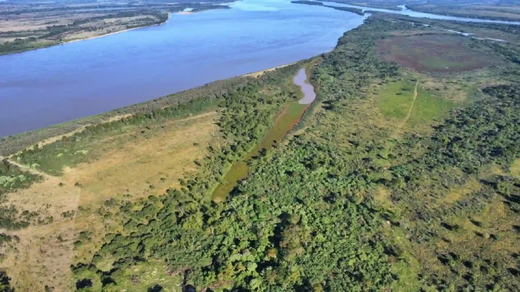
Campo de isla sobre el margen del río Paraná, Entre Ríos, con vegetación de canutillo y camalote

A unique feature of Entre Ríos: the island fields

Cattle ranches located on the banks of the Paraná or Uruguay rivers are valued according to their own criteria.

Its high natural forage productivity (canutillo, camalote) coexists with risks of flooding and particular logistical dynamics, such as the movement of livestock on rafts.

It is an area that requires specific experience in order not to undervalue or overvalue the establishment.

costs

The cost varies depending on the surface area, location, and purpose of the report (a report for internal use is not the same as one valid for presentation to a bank or a court).

That's why we prefer to discuss it on a case-by-case basis: it may Contact us without obligation and we confirm the scope and cost according to your specific situation.

Don't wait any longer

Ask about free, no-obligation valuations.

If you need to appraise a property in Entre Ríos, whether for sale, inheritance, or to determine the value of your assets, you can contact us via WhatsApp or leave your inquiry and we will respond with the following steps.

E-mail

Write to us whenever you want

info@camposenentrerios.com
Call us

At your service

+54 (343) 4718158
Visit us

In Green Gold

Los Chañares 120
Office Hours :
Monday to Friday: 9:00 – 12:00 and 16:00 to 19:00 | Saturdays: 9:00 – 12:00

Frequently Asked Questions